Bis zu 80% Zeitersparnis bei der Auftragsbearbeitung.
Genial...
Keine Stapelverarbeitung, sondern intelligenter Compiler.
Effizient...
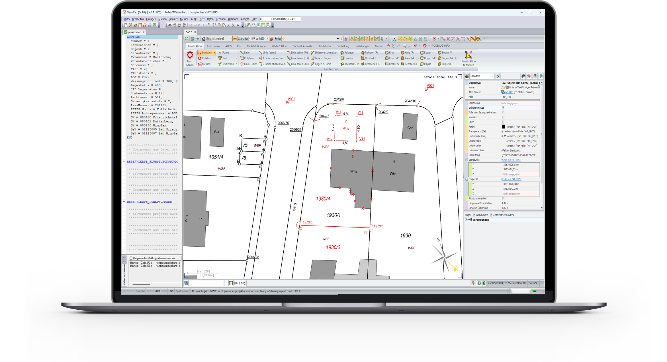
Durch intelligente Fehlersuche und Anzeige. Messen, Berechnen, Abstecken und Zeichnen in einen Programm.
Zuverlässig...
Durch eine hochgradig automatisierbare Projektbearbeitung.
Aktuelles
Bachelor-Arbeit zu VermCad
Lisa Hellgermann
Die Autorin zieht darin folgendes Fazit:
"VermCad erfüllt alle notwendigen Bedingungen, die an eine EQK in Baden-Württemberg gestellt werden. …
Weiterlesen
Vollständige Fortführung
NEU Baden-Württemberg
Die vollständige ALKIS Fortführung steht ab sofort zum Download bereit.
Weiterlesen
Validierung der Fortführungsdaten
NEU Baden-Württemberg
Die Fortführungsdaten werden über ein konfigurierbares Tool auf Gültigkeit validiert.
Weiterlesen
Messen und Abstecken
NEU Baden-Württemberg
Es wird direkt beim Messen im Feld geprüft, ob vorschriftenkonform gemessen wurde.
Weiterlesen
Kundenfeedback
Stadtvermessung Magdeburg
Die Software VermCad hat all unsere Probleme im Bereich Katastervermessung umfassend und effektiv gelöst.
Jan Walbert
VermCad ist nach langjährigem Arbeiten mit mehreren anderen Katasterprogrammen hinsichtlich Bedienung, Geschwindigkeit.... das Beste, was es wohl derzeit auf dem Softwaremarkt gibt.
Vermessungsbüro Knöfel Weißwasser
Wir arbeiten seit Jahren mit VermCad und sind super zufrieden, auch was die Wartung betrifft. Das Wichtigste: das Preis - Leistungsverhältnis stimmt!
Dietmar Schrottner
Ohne Schnörkel, geradlinig, klar und verständlich, effizient - einfach einmal ausprobieren!